


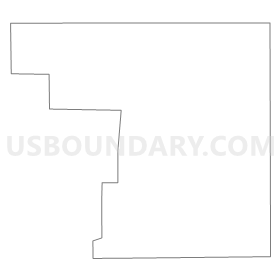
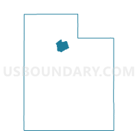
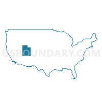
Voting District 2222.2, Salt Lake County, Utah
About
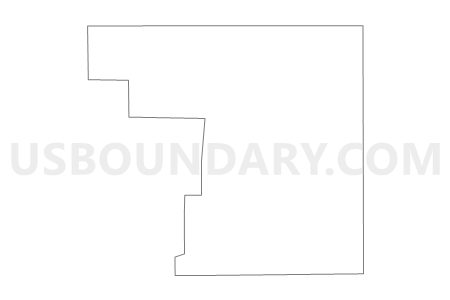
Outline
Summary
| Unique Area Identifier | 678979 |
| Name | Voting District 2222.2 |
| County | Salt Lake County |
| State | Utah |
| Area (square miles) | 8.08 |
| Land Area (square miles) | 8.08 |
| Water Area (square miles) | 0.00 |
| % of Land Area | 100.00 |
| % of Water Area | 0.00 |
| Latitude of the Internal Point | 40.75057730 |
| Longtitude of the Internal Point | -112.05065610 |
Maps
Graphs
Select a template below for downloading or customizing gragh for Voting District 2222.2, Salt Lake County, Utah


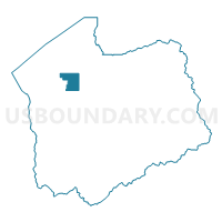
Neighbors
Neighoring Voting District (by Name) Neighboring Voting District on the Map
- Voting District 1126, Salt Lake County, UT
- Voting District 1203, Salt Lake County, UT
- Voting District 1302, Salt Lake County, UT
- Voting District 2050.2, Salt Lake County, UT
- Voting District 2222.1, Salt Lake County, UT
- Voting District 9102, Salt Lake County, UT
- z Unpopulated 8100, Salt Lake County, UT
Top 10 Neighboring County Subdivision (by Population) Neighboring County Subdivision on the Map
Top 10 Neighboring Place (by Population) Neighboring Place on the Map
Top 10 Neighboring Unified School District (by Population) Neighboring Unified School District on the Map
Top 10 Neighboring State Legislative District Lower Chamber (by Population) Neighboring State Legislative District Lower Chamber on the Map
- State House District 22, UT (40,669)
- State House District 26, UT (33,477)
- State House District 23, UT (31,676)
Top 10 Neighboring State Legislative District Upper Chamber (by Population) Neighboring State Legislative District Upper Chamber on the Map
Top 10 Neighboring 111th Congressional District (by Population) Neighboring 111th Congressional District on the Map
Top 10 Neighboring Census Tract (by Population) Neighboring Census Tract on the Map
- Census Tract 1134.07, Salt Lake County, UT (10,940)
- Census Tract 1145, Salt Lake County, UT (6,037)
- Census Tract 1139.06, Salt Lake County, UT (3,969)
- Census Tract 9800, Salt Lake County, UT (0)